Sign in. It’s quick, free and it’s up to you.
An account is an optional way to support the work we do. Find out more.
Sign in. It’s quick, free and it’s up to you.
An account is an optional way to support the work we do. Find out more.
LAST UPDATE | 8 Feb 2021
Yellow - Snow and Ice Warning
— Met Éireann (@MetEireann) February 8, 2021
For Antrim, Armagh, Down, Tyrone
UK Met Office Weather Warning (https://t.co/BFu6qGik8M)
Snow showers and icy stretches over parts of Northern Ireland leading to some travel disruption
Valid: 17:00 Monday 08/02/2021 to 11:00 Tuesday 09/02/2021 pic.twitter.com/3hcAovmb5y
A STATUS YELLOW snow/ice warning has been issued for Dublin, Kildare, Louth, Wicklow, Meath and Monaghan.
The warning will be valid from 6pm this evening until 6pm tomorrow. Met Éireann said snow accumulations of two to five centimetres can be expected in places.
A similar warning is in place for counties Antrim, Armagh, Down and Tyrone from 5pm this evening until 11am tomorrow with snow showers and icy stretches due.
A nationwide weather advisory notice is also in place with parts of the country experiencing snow showers.
The warning kicked in at 6am yesterday and is valid until 6pm on Wednesday, with very cold temperatures, sharp, severe frosts and sleet and snow in eastern counties expected while the notice is in place.
In an update given this lunchtime, Met Éireann said that the risk of snow showers will increase over the next few days, with eastern counties at greatest risk.
The forecaster said: “The risk of snow accumulations will increase tonight, through tomorrow and for a time on Wednesday before the main focus for snowfall risk turns to the attempted frontal breakdown from the Atlantic on Thursday and Friday.”
In a statement this afternoon, the National Directorate for Fire and Emergency Management on Severe Weather said State agencies have been meeting daily to monitor forecasts and predicted impacts.
“Wintry showers will remain in the east and northeast again on Wednesday. Given the low temperatures, it is unlikely any remaining snow from Tuesday will thaw,” it said.
“Cold temperatures are predicted throughout the coming days, with night temperatures likely to be below freezing in most areas, and daytime temperatures will remain low also.
“Thursday could potentially bring widespread snowfall and significant accumulations across the country, bringing a potential for considerable disruption.
Local authorities outlined preparedness actions which local authorities are leading on, including:
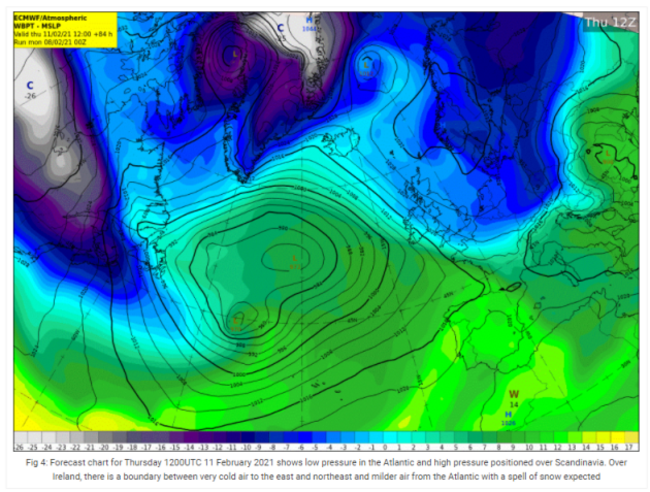
Parts of the UK and central Europe have already experienced heavy snowfall over the weekend, but those hoping for (or dreading) similar conditions here will have to wait a few more days to find out if Ireland will be blanketed or if warmer weather is on the way.
Unlike conditions on the continent, Ireland’s cold front originates from Scandinavia, which will bring gusty winds with a significant wind-chill factor today.
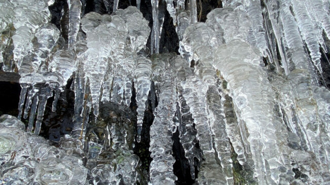
The more easterly cold snap in Europe is being driven by winds which Dutch meteorologists have named Storm Darcy, which is packing winds of up to 90km an hour. The storm is not expected to reach Ireland.
Nevertheless, daytime temperatures over the next few days are expected to be in the low single figures and the risk of icy roads and footpaths is expected to increase.
Some snowy showers are expected later today and during Tuesday, but will initially be restricted to eastern parts of Leinster and Ulster before arriving further inland tomorrow.
Met Éireann has said that there is still “a high degree of uncertainty” about the forecast from Wednesday onwards, but it appears now as if milder air from the Atlantic will displace the cold air over Ireland from midweek.
However, the forecaster has warned that if that mild frontal system becomes less energetic and more slow-moving as it nears Ireland, some parts of the country could see more significant and lasting snowfall later this week.
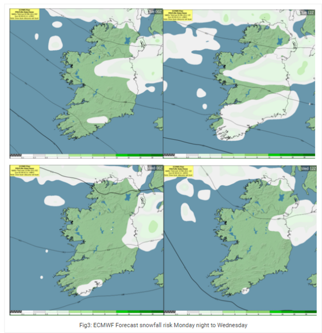
Today will be cold and breezy, with highest temperatures of just one to four degrees, dropping to lows of -3 to +1 with icy stretches tonight.
Conditions will be similar tomorrow, with bright sunny spells on another cold and breezy day, with afternoon temperatures of just one to three degrees Celsius, and a very cold night on Tuesday with lows of -4 to 0 degrees.
International
Most of England and Scotland are already covered by snow and ice warnings amid the ongoing cold snap across the Irish Sea.
Many parts of the UK face another day of temperatures at or around freezing point, as bitterly cold conditions continue due to the strong easterly winds stemming from Ukraine and the Black Sea.
But the cold weather is not expected to be as widespread as the Beast From The East in 2018.
Forecasters in the UK are warning of a strong chance of roads becoming blocked by deep snow, with snow accumulations of 5-10 centimetres in affected areas, reaching up to 30cm at “a few sites”.
The BBC said the UK was “starting to see the whites of the eyes” of Storm Darcy.
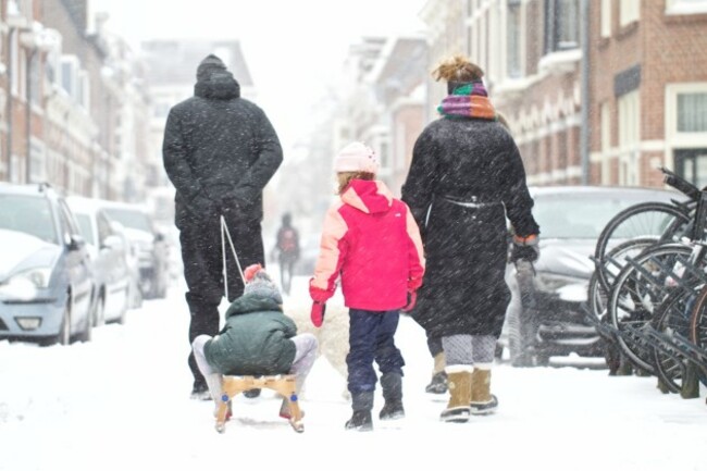
The Netherlands and parts of Germany were blanketed by snow following the arrival of Darcy yesterday, which disrupted planes and trains and put some Covid-19 testing on hold.
People sledded and played in the snow in Dutch and German cities despite the bitterly cold conditions where temperatures dropped as low as minus 5 degrees Celsius.
Dutch authorities declared a rare “code red” emergency for the entire country as it was hit by its first proper snowstorm in more than a decade. The last snowstorm took place in January 2010.
Dozens of flights were delayed or cancelled at Amsterdam’s Schiphol airport while Eindhoven airport in the south of the country scrapped all services. All trains were cancelled in the Netherlands, including international services to Germany.
Hopes of a 200km ice-skating marathon through 11 cities called the Elfstedentocht, which would have been held for the first time since 1997, were dashed due to Covid-19 restrictions.
In Germany, snowfall caused major disruption to trains and cancellations of services between cities including Hamburg and Hanover.
Thick snow of up to 30cm disrupted road traffic, with hundreds of accidents and part of a motorway in North Rhine-Westphalia closed by police after it turned into an ice rink.
Belgium received a light dusting of snow but was expecting a big temperature drop as the week progresses.
Contains reporting from © AFP 2021, Gráinne Ní Aodha and Orla Dwyer.

To embed this post, copy the code below on your site















have your say